WALKS ON THE LLŶN PENINSULA
Without a doubt, the Llŷn Peninsula has stunning scenery to offer. From mountains to coastline, from rolling countryside to ancient castles and forts. There are lots of walks which take in all that the Llyn has to offer and with Yr Eifl, Tre’r Ceiri and Nant Gwrtheyrn right on Gors-lŵyd’s doorstep what’s not to like?!
Here are just a few of our favourites. There are plenty of maps, walking guides and routes supplied for you to use when you visit Gors-lŵyd.
YR EIFL & TRE’R CEIRI
Gors-lŵyd Cottage is in a perfect location to take advantage of a walk up the highest mountain on the Peninsula – Yr Eifl. Yr Eifl is actually three peaks – Tre’r Ceiri, Garn Ganol and Garn For.
Garn Ganol (known as Yr Eifl) is the highest at 564m.
Tre’r Ceiri is an Iron Age Hillfort, regarded as one of the best examples in northern Europe
Garn For has been extensively quarried. The quarried granite was used for paving stones and curling stones.
To walk up Yr Eifl or Tre’r Ceiri turn right from Gors-lŵyd’s gate and you are on your way! Follow the footpath up to a kissing gate (look behind you here and you will see the bays of Nefyn and Morfa Nefyn in the distance) and then follow the waymarked paths from there on. Don’t forget your camera!


NANT GWRTHEYRN
Nant Gwrtheyrn (or just The Nant) is a walk across the mountain from Gors-lŵyd. Head out of Gors-lŵyd’s gate and turn right, take the track on the left which goes past the house called “Bryn Ffynnon”. This path takes you over the mountain and onto the road to Nant Gwrtheyrn. Turn right onto the road and head down toward the Nant.
Nant Gwrtheyrn is a Welsh language learning centre which also has a cafe and small visitors centre. The road down to the Nant is stunning and the mountain and sea views can take your breath away. The walk is circular and starts from Nant Gwrtheyrn. A walk along the beach and then onwards and upwards through woodland and fields follows a coastal path. Then the path takes you across fields and back to the top of the road down to the Nant. Just stunning.


PORTHDINLLAEN
A trip to Porthdinllaen is a must when staying at Gors-lŵyd. This location is home to one of the best situated pubs (Tŷ Coch) on the peninsula and has a golf course on the headland up behind it.
Porthdinllaen also has a lifeboat station and a small information cabin, which delves into the history of the place and it’s people.
There is limited parking in Morfa Nefyn except for the National Trust car park, which is located just above the beach road. If the tide is high then you need to go across the golf course to reach Porthdinllaen. If the tide is out, there are steps down from the cliffs in front of the car park to the beach below. You can easily see if you can make it around on the beach from the vantage point in the car park. There are also excellent views from here of Yr Eifl further up the coast.
When walking down onto the beach, turn left and follow the beach round. At the first house along the beach, only at low tide can you get around on the sand, so if it is mid tide or higher you will need to walk up the slipway and across the front of the house onto a path that leads back onto the beach on the other side. The next section requires you to walk around the back of the house that is partially suspended over the water whatever the tide. This path then leads you onto the beach at Porthdinllaen.
For a longer circular walk, continue straight over this beach and in between the houses at the other end to continue following the path around the headland. This path isn’t very wide and is uneven in places. It eventually comes out on the lifeboat beach, from where you need to follow the track up behind the lifeboat station and then on through the golf course, either turning back down into the village on the concrete road or carrying on to the top of the course and the clubhouse, where the road then leads from back down to the car park. Video below is courtesy of Visit Snowdonia.


PORTH OER/PORTHOR (WHISTLING SANDS)
A stunning circular walk following the Wales Coastal Path. Starting from the National Trust car park at the beach, head away from the beach to start the walk along country lanes. Eventually the circular path will take you along some of the most beautiful coast on the Llŷn Peninsula. The walk ends at Porth Oer/Porthor (Whistling Sands). There is a cafe here – a great end to a fabulous walk!


ABERDARON
Starting in the seaside village of Aberdaron, this circular route is mainly a cliff-top walk of around 7 miles. Aberdaron is a quaint village with car park, cafe, pubs and a small shop. Taking in spectacular views of Bardsey Island, the walk takes in the coves of Porth Meudwy (where you can take boat trips to Bardsey), Porth y Pistyll and Pen y Cil. The video below shows highlights of Aberdaron and the cliff-top walk (video courtesy of Visit Snowdonia)


PORTH YSGO
To get to Porth Ysgo head for Aberdaron village centre, where you will see a signpost for Rhiw which you should follow and then head out of the village up a steep hill, with the churchyard on your right. Within two miles you will come across a crossroads with a post box on the left, turn right here and you should come to what looks like a disused farm, with a pond on the left. further on the road park in a small lay-by on the right.
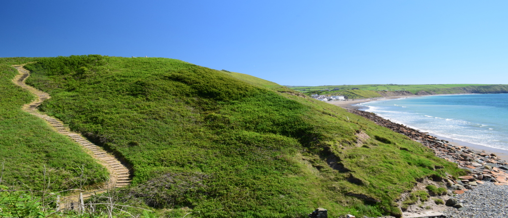
Porth Ysgo is nestled within the cliffs between Porth Neigwl/Hell’s Mouth and Aberdaron. The descent to the beach is down a flight of over 150 steps, crisscrossing the side of the cliff. If you want to miss out all of these steps though, you can! So don’t be put off if you would still like to explore this area, However, it is worth noting that the paths are steep and uneven in places.
Start from the car park at the farm. You should be able to see a public footpath sign pointing down a rough track. Follow the public footpath to the left slightly and you will soon find yourself following a small stream in the bottom of the small valley. When the valley opens out at the end you should find yourself looking out across the sea across to Bardsey Island in the distance. A narrow dirt path leads off to the right, follow this to the top of the cliff and the top of the steps to the beach. If you don’t want to go down the 150 or so steps, you should stay on the previous path, which follows the hillside round to the left. If you choose to go down to the beach, follow the same steps back up to the top of the cliffs to get back to the main path. Once back on this path, continue around the hill side, rather than going back the way you came.
You will come to a style and you should see another small stream. Walk upstream following the path. This path leads all the way back up to a country lane. When you get to this lane turn left and after just over about a quarter of a mile, you will find the car park you started on. A beautiful walk with stunning scenery.


